National Forests Propose Higher Day Use Fees
National Forests in North Carolina are considering higher day use fees.
Carolina Outdoors Guide – Parks & Forests – Camping – Hiking – Adventures


North Carolina has national parks located from the shores of the Outer Banks to the mountains at the Tennessee border and in the state’s Piedmont and Coastal Plains. Portions of the Appalachian National Scenic Trail (see our Hiking page), the Overmountain Victory National Historic Trail and the Trail of Tears National Historic Trail cross North Carolina, as well.
The parks offer recreational opportunities ranging from backpacking and primitive camping to snorkeling and windsurfing, home tours and museum exhibits.
Some federal recreation lands charge access fees as well as activity fees, such as for camping. You can get an annual pass that gets either a single private car and its occupants in or the pass holder plus three adults into places with a per-person charge (younger than 15 are not charged). There are also passes for seniors and the disabled that offer discounts and are good for life, free annual passes for active duty military and their dependents, and for park volunteers who volunteer 250 hours on recreation lands managed by one or more of five federal agencies.
Note: National Parks websites change frequently. If a link below doesn’t work, it should lead to a Park Service page with a search tool. Try a search; the feature we linked to probably still exists.
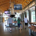
199 Hemphill Knob Road
Asheville, NC 28803-8686
(828) 271-4779 / (828) 298-0398 (recorded information)
Locator Map (Parkway Visitor Center at Asheville) / Parkway Map / Visit Website
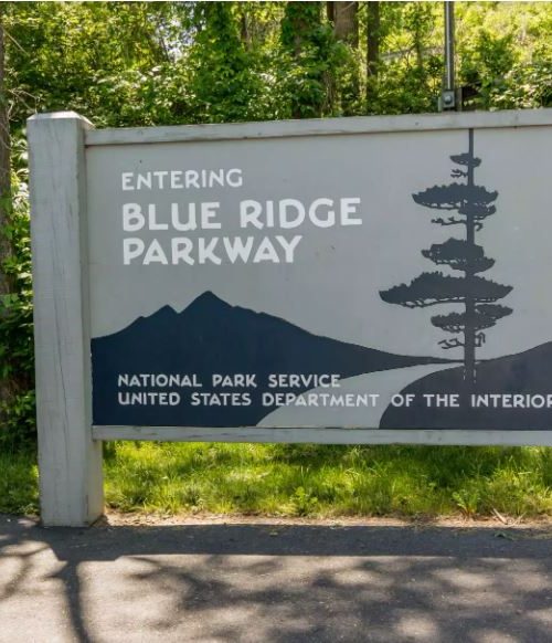
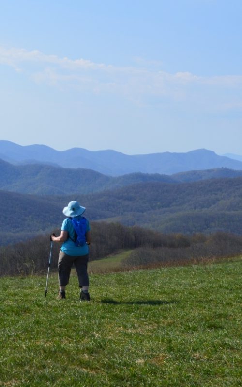
The most visited site in the National Parks system extends 469 miles through the southern Appalachians of North Carolina and Virginia following the crest of the Blue Ridge Mountains. The Parkway and Great Smoky Mountains National Park (below) are in the Blue Ridge National Heritage Area. More people enter or exit the Parkway in Asheville than any other point on the road. Visitors enjoy automobile and bicycle touring, overlooks, bird watching, camping, climbing, cross-country skiing, fishing, hang gliding, hiking, historical and cultural demonstrations, hunting, picnicking and ranger programs.
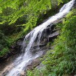
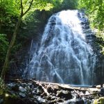

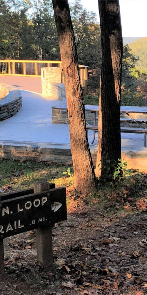
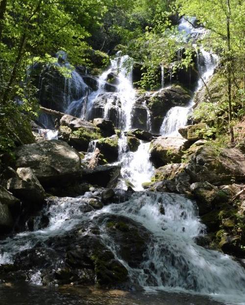
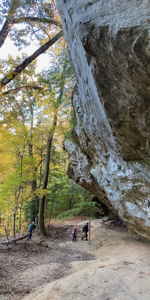
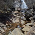 trail that goes to waterfalls in the Pisgah National Forest. A portion of the Mountains-to-Sea Trail accessible here connects to the Shining Rock Wilderness. Blueberries are abundant in the summer. Vault toilet, parking. Click on the photo at left for more information.
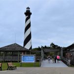 Cape Hatteras National Seashore
1401 National Park Drive
Manteo, NC 27954
(252) 473-2111
Locator Map (Rodanthe) / Park Map / Visit Website
Special recreational features of these 70 miles of barrier islands include some of the East Coast’s finest fishing and surfing, plus the Cape Hatteras, Bodie and Ocracoke lighthouses. Public ferries run to Ocracoke Island. There are visitor centers on three islands; the park is used for automobile and bicycle touring, bird and wildlife watching, boating, camping, fishing, hiking, hunting, kayaking, ranger programs, snorkeling, swimming, windsurfing. Click on the photo for more information.
131 Charles Street
Harkers Island, NC 28531
(252) 728-2250
Locator Map / Park Map / Visit Website
Three undeveloped barrier islands extend 56 miles along the Southern Outer Banks and feature beaches, dunes, historic Portsmouth Village and Cape Lookout Lighthouse. Bird and wildlife (including wild horses on Shackleford Banks) watching, boating, canoeing, camping (primitive and cabins), fishing, hiking, hunting, kayaking, off-road driving, picnicking, ranger programs (summer), shelling, sunbathing, swimming, windsurfing are available. The visitor center is at end of Harkers Island Road off U.S. 70. The seashore is accessible via a concessions ferry service operating from downtown Beaufort and the visitor center, or by personal boat. The lighthouse is open for climbing Tuesday through Saturday, from the second week in May to the third weekend in September.
81 Carl Sandburg Lane
Flat Rock, NC 28731-8635
(828) 693-4178
Locator Map / Park Map / Visit Website
Connemara was the farm home of the noted poet-author for the last 22 years of his life. There are two lakes, several ponds, gardens, pastures and an apple orchard on the 30-acre site; the front lake trail is partially handicapped-accessible. The site offers a 30-minute guided house tour (adults are charged a fee), bird and wildlife watching, hiking and historic barn with goat herd. Each Memorial Day the site hosts the Carl Sandburg Folk Music Festival and, in June through mid-August, presents live performances of Sandburg’s “Rootabaga Stories” and excerpts from the Broadway play, “The World of Carl Sandburg.”
1401 National Park Drive
Manteo, NC 27954
(252) 473-2111 (headquarters)
(252) 473-5772 (visitor information)
Locator Map / Park Map / Visit Website
The first English settlement in North America was attempted here (1585-87) and the fate of Sir Walter Raleigh’s Lost Colony remains a mystery. In addition to a visitors center and museum, the park is home to Elizabethan Gardens and, “The Lost Colony” outdoor symphonic drama in summer, and commemoration of Native American culture and Civil War activities, including the Freedman’s Colony. Bird and wildlife watching, nature trails and ranger programs are also available.
 107 Park Headquarters Road
Gatlinburg, TN 37738
(865) 436-1200 (recorded message)
Locator Map / Park Map / Visit Website
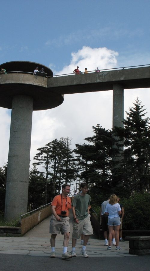
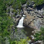
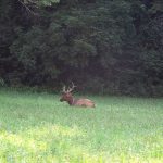
Encompassing portions of North Carolina and Tennessee, Great Smoky Mountains National Park features a diversified plant and animal life, and preserves structures representing southern Appalachian mountain culture. There are six visitors centers, two grist mills, and opportunities for automobile and bicycle touring, backpacking, bird and wildlife watching, camping, fishing, hiking on more than 800 miles of trails, horseback riding, picnicking and ranger programs. The park has a dozen waterfalls. Clingmans Dome, the highest point in the park (elev. 6,643 feet), has an observation tower and is accessible from Clingmans Dome Road off of U.S. 441 at Newfound Gap. Clingmans Dome Road is closed in winter. Click on the photo for more information.
2332 New Garden Road
Greensboro, NC 27410-2355
(336) 288-1776
Locator Map / Park Map / Visit Website
The battle fought here on March 15, 1781, was the largest action of the Revolutionary War’s climactic Southern Campaign. In addition to a visitors center, the park has 28 monuments, including a memorial to North Carolina’s three signers of the Declaration of Independence, walking trails, automobile and bicycle tour road, and living history programs on Independence Day, Memorial Day and other times.
40 Patriots Hall Drive
Currie, NC 28435
(910) 283-5591
Locator Map / Park Map / Visit Website
The park commemorates the February 27, 1776, Battle of Moores Creek Bridge, the first decisive Patriot victory of the Revolutionary War and the end of British authority in the North Carolina colony. The park offers a visitors center, picnic area, museum and a walking trail with historic markers, memorials and the historic bridge. The annual battle commemoration the last full weekend of February features a living history encampment, tactical demonstrations and more.
1401 National Park Drive
Manteo, NC 27954
(252) 473-2111 (headquarters)
(252) 441-7430 (visitor information)
Locator Map / Park Map / Visit Website
The first successful sustained powered flights in a heavier-than-air machine were made here at Kitty Hawk by Wilbur and Orville Wright on December 17, 1903. Inside the visitors center are replicas of the Wrights’ gliders and other exhibits, and another pavilion has exhibits and a film; outside are the 60-foot-tall granite Wright Memorial atop a 90-foot dune, reconstructed camp buildings, and markers showing where the flyer touched down along the original flight path. Click on the photo for more information.
Carolina Music Festivals, a calendar and guide to music festivals in North Carolina.
More results...